Top of the World
Elevation: 2,080m
High above the Bike Park, West Bowl XC (formerly named Altitude) is a lift-access loop that starts from the top of the Sunburst Express chairlift. You’ll climb through wildflower meadows, forests, and past the peak of Tod Mountain, before reaching tranquil Tod Lake. From there the trail descends back towards the chairlift, where you can connect with Level Up for a fun, flowy ride back to the village, completing 16km of beautiful alpine riding. Looking for a more advanced way down? Connect from West Bowl XC to Sugar and then Sweet One for a rip down some classic Sun Peaks tech.
Big Rock Ride, also lift-access, offers an undulating ride through sub-alpine forests before connecting back into the Bike Park at the top of Sundance Mountain.
Please note: a valid lift ticket or season pass is required to ride any of the Bike Park trails, including Altitude and Big Rock Ride.
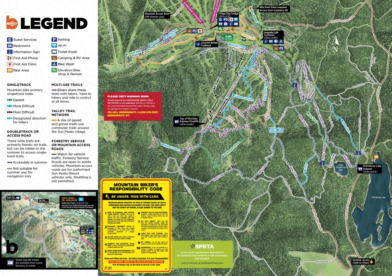
Outside the lift-access Bike Park, the Valley trail network offers a growing selection of free-to-use pedal-access trails to explore. The Morrisey/Valley pedal-access network is available for use free of charge.
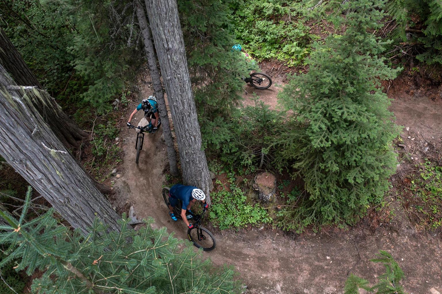
On Mt. Morrisey, experience scenic views and lush cedar forest via a network of five new trails. Cedar Twist, a 6km singletrack climb trail, starts near the base of the Morrisey Express and provides access to the top of Morrisey. Be mindful of hikers while riding, as this is a shared-use trail. Once at the top, you can extend your ride on Sticky Fingers, an out-and-back trail near the peak of Mt. Morrisey. When you’re ready to head down, pick between Calypso Groove, El Diablo, or Stumpwheed for a thrilling descent.
Additional trails exist around Morrisey and elsewhere in the valley, including a mix of singletrack cross country style trails and doubletrack access roads. With trails to suit most levels of rider, they are a great option for an evening pedal or a family ride out to McGillivray Lake. This network is usually ready to ride in early to mid-June and closes when the snow arrives in late October.
Pedal-access trails are developed and maintained by the Sun Peaks Recreational Trail Association (SPRTA), a dedicated group of community trail builders. While the trails are free to use, membership support helps make them possible, funding ongoing trail building, maintenance and improvements throughout the Sun Peaks trail network.
Support local trails — SPRTA memberships start at $25 per year.
Find trails and plan your next ride with Trailforks. Explore interactive maps, get trail and route recommendations, see updates from fellow riders, browse photos and videos, and track your mileage with GPS devices.
In the pursuit of creating flow, we’re often focused on pushing it to new heights. Speed and amplitude shape the priority of progression as we carve out our experiences.
But long before Brady Starr of Starr Trail Solutions and Sam Loxton of the Sun Peaks Recreational Trail Association began sketching blueprints for pedal-access trails on Mt. Morrisey, they had a different kind of flow in mind, one that pushed the riding experience to greater depths.